Classroom lesson 路 A country made by rivers馃嚙馃嚛 Bangladesh

A country made by rivers

Three giant rivers meet here - and the land is almost flat

A satellite view of the Ganges-Brahmaputra delta, showing green land laced with bright silver rivers reaching the sea

Photo 路 Wikimedia Commons 路 ESA

What is it?

Bangladesh is shaped by water. Three of Asia's biggest rivers - the Ganges, the Brahmaputra and the Meghna - all flow across the country and meet at the sea. They have built almost the entire country out of the soft, rich mud they carry. It is the largest river delta in the world.

Tell me more

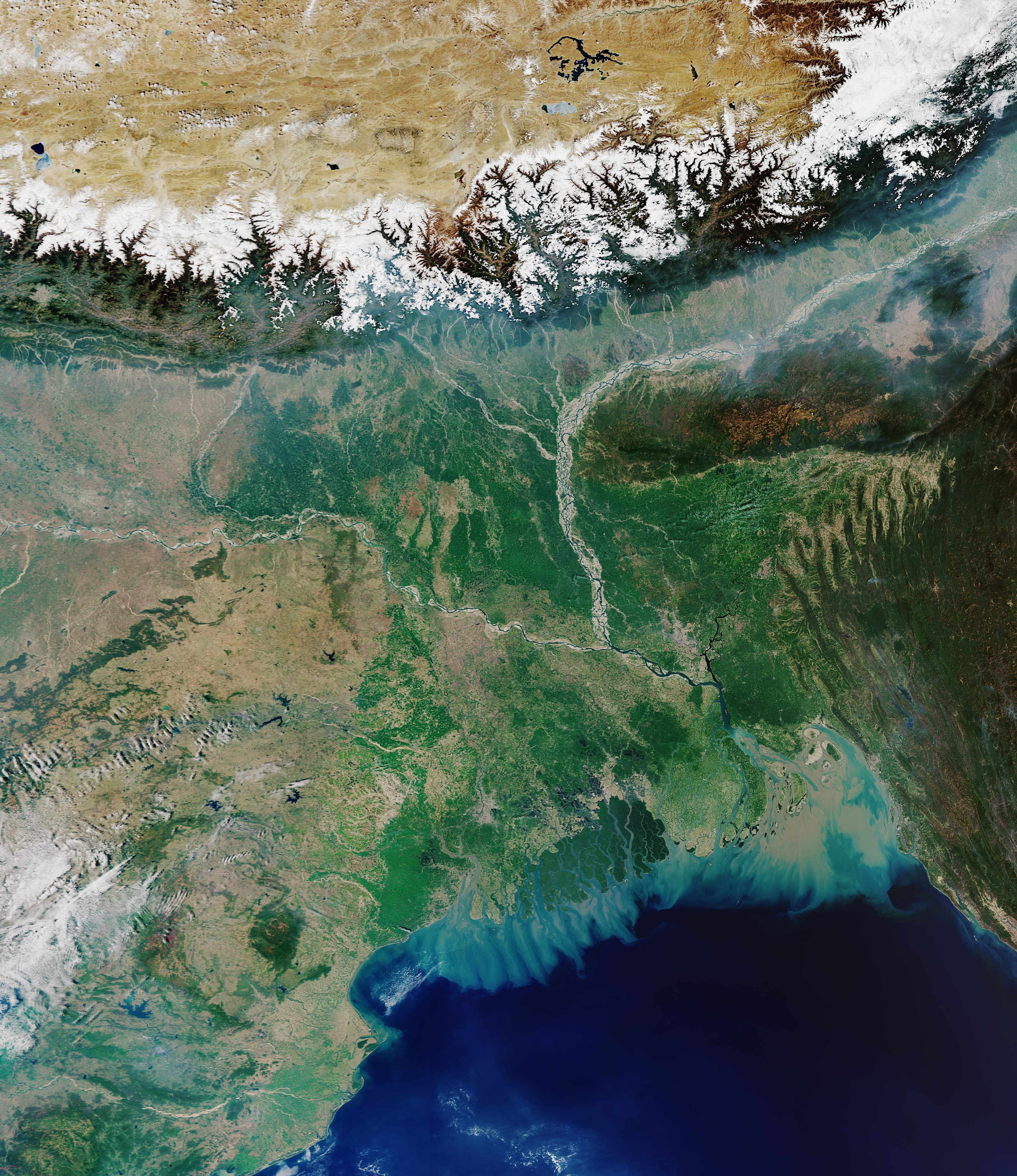
Look at Bangladesh from space (like the photo above) and you can see it: green land laced with silver-grey rivers, like a giant leaf with veins. There are more than 700 rivers in the country. Many children take a boat to school instead of a bus.

The rivers all start far away in the Himalayan mountains. When the snow on the mountains melts, and when the monsoon rains arrive in summer, the rivers swell up. They flow downhill across the flat plains of Bangladesh, carrying tiny bits of mountain rock with them all the way to the sea.

That mud is gold dust for farmers. When the rivers spill over their banks each year, they leave a fresh layer of fertile soil behind. Rice, jute, tea and vegetables all grow brilliantly in it. Bangladesh is one of the biggest rice-growing countries in the world.

Because the country is so flat and so full of water, boats matter more than cars in many places. Markets float on the water. Big wooden ferries chug between islands. In quiet creeks, a fisherman might be standing in a tiny canoe, balancing perfectly while throwing a net.

In the classroom

Walk your class through this in 15 minutes.

Talk together

Discussion prompts

  1. 01How does a river change the shape of the land it flows through?
  2. 02Why might a country full of rivers grow lots of rice?
  3. 03If you got to school by boat every day, what would the journey be like compared to yours?
Try this

Classroom activity

On a map, trace one river all the way from its source in the mountains to the sea. Mark how many countries it passes through. Then sketch a 'river-school' journey - your school in the middle, all the ways pupils could arrive by water: ferry, canoe, on a friend's boat.